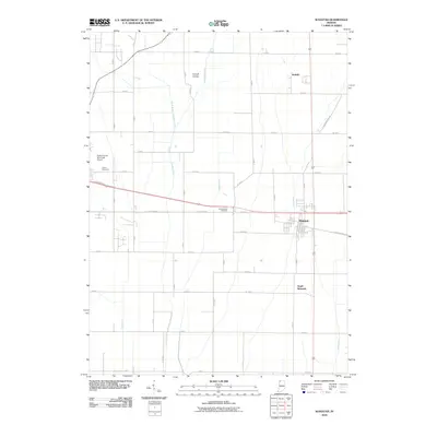
2010 Map of Wanatah
USGS Topo · Published 2010About this map
Wanatah serves as the central hub of this agricultural landscape in Porter and LaPorte counties, where the intersection of major roads and drainage networks defines the local geography. The settlement patterns extend to South Wanatah and the small community of Haskell to the north. Water management is a primary feature of the terrain, visible through an extensive system of engineered waterways such as Greiger Ditch, Slocum Ditch, and Koselke Ditch, which support the surrounding farmland. Aviation history and local transit are represented by the Porter County Municipal Airport and the smaller Wyckoff Airstrip. Genealogists and local historians can locate established burial grounds like Luther Cemetery and Sacred Heart Cemetery, providing clear geographic markers for family research in this part of Northwest Indiana.
Find a feature on this map
37 named features on this map. Tap any name to fly to it.
Don’t see what you’re looking for? This feature index may not catch every label — zoom into the map to look around manually.
Map Details
Editions of this 2010 Wanatah Map
This is the sole edition of this map. No revisions or reprints were ever made.
Other maps of this area

1934 · Porter
USGS Topo · 1:48,000

1940 · Porter
USGS Topo · 1:62,500

1953 · Wanatah
USGS Topo · 1:24,000

1953 · Westville
USGS Topo · 1:24,000

1953 · Valparaiso
USGS Topo · 1:24,000

1953 · Chesterton
USGS Topo · 1:24,000

1953 · Kouts
USGS Topo · 1:24,000

1953 · Chicago
USGS Topo · 1:250,000

1957 · Chicago
USGS Topo · 1:250,000

1958 · La Crosse
USGS Topo · 1:24,000