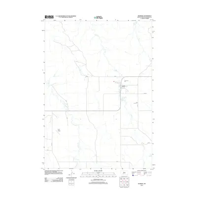
2012 Map of Wanblee
USGS Topo · Published 2012About this map
Wanblee stands as a central community within this South Dakota landscape, surrounded by a network of local roads and watercourses. The settlement is anchored by local landmarks including the Tiyoko Itopa community area and the nearby Gethsemane Cem. To the east, Saint Ignatius Cem is situated near Camp Ave, while the local hydrology is defined by the winding paths of Craven Cr and the presence of Wanblee Lake. This 2012 survey illustrates a modern rural infrastructure, where private and public interests meet at the Porch Ranch Airport. The terrain is deeply etched by a system of drainage including Eagle Nest Cr and Long Cr, which shape the ranching and residential layout of Jackson County during this period.
Find a feature on this map
20 named features on this map. Tap any name to fly to it.
Don’t see what you’re looking for? This feature index may not catch every label — zoom into the map to look around manually.
Map Details
Editions of this 2012 Wanblee Map
This is the sole edition of this map. No revisions or reprints were ever made.
Other maps of this area

1950 · Interior SE
USGS Topo · 1:24,000

1950 · Wanblee
USGS Topo · 1:24,000

1951 · Wanblee NW
USGS Topo · 1:24,000

1951 · School Section Butte
USGS Topo · 1:24,000

1951 · Wanblee NE
USGS Topo · 1:24,000

1955 · Martin
USGS Topo · 1:250,000

1958 · Martin
USGS Topo · 1:250,000

1980 · Kadoka
USGS Topo · 1:100,000

1981 · Broken Leg Dam
USGS Topo · 1:24,000

1981 · Hisle
USGS Topo · 1:25,000