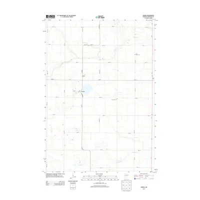
2013 Map of Wanda
USGS Topo · Published 2013About this map
Wanda serves as the central hub for this rural agricultural landscape in Redwood County, where the town's small grid is anchored by a Po at the intersection of Main St and S Railroad St. The surrounding countryside is defined by a rigorous section-line road system, including routes like Co Hwy-4 and Co Hwy-17, which connect isolated homesteads such as the Bellig Farm to the town center. The drainage patterns of Sleepy Eye Cr in the north and Coal Mine Cr in the south carve gentle depressions into the otherwise orderly prairie. For those researching local family history, several burial grounds are preserved across the township, including Wanda Cem, Saint Mathias Cem, and Trinity Lutheran Cem, each situated along different county roads to serve the dispersed farming community.
Find a feature on this map
26 named features on this map. Tap any name to fly to it.
Don’t see what you’re looking for? This feature index may not catch every label — zoom into the map to look around manually.
Map Details
Editions of this 2013 Wanda Map
This is the sole edition of this map. No revisions or reprints were ever made.
Other maps of this area

1953 · New Ulm
USGS Topo · 1:250,000

1957 · New Ulm
USGS Topo · 1:250,000

1958 · New Ulm
USGS Topo · 1:250,000

1967 · New Ulm
USGS Topo · 1:250,000

1967 · Wanda
USGS Topo · 1:24,000

1967 · Sanborn
USGS Topo · 1:24,000

1967 · Clements
USGS Topo · 1:24,000

1967 · Wabasso SE
USGS Topo · 1:24,000

1967 · Wabasso
USGS Topo · 1:24,000

1967 · Clements SE
USGS Topo · 1:24,000