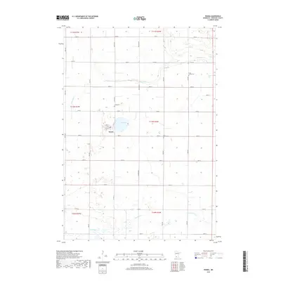
2019 Map of Wanda
USGS Topo · Published 2019About this map
Wanda serves as the central hub of this agricultural landscape in Redwood County, situated along a grid of section roads like Co Rd 4 and Justice Ave. The town itself is organized around Main St, North St, and South St, showing the compact residential and commercial footprint typical of rural Minnesota prairie settlements. This 2019 survey documents a region defined by its water systems and local heritage, with Sleepy Eye Cr winding through the northern sections and Coal Mine Cr to the south. Genealogists and local historians can locate several burial grounds preserved in the township, including Trinity Lutheran Cem, the Saint Mathias Cem to the east of town, and Wanda Cem located just north of the village center near Willow Lake.
Find a feature on this map
34 named features on this map. Tap any name to fly to it.
Don’t see what you’re looking for? This feature index may not catch every label — zoom into the map to look around manually.
Map Details
Editions of this 2019 Wanda Map
This is the sole edition of this map. No revisions or reprints were ever made.
Other maps of this area

1953 · New Ulm
USGS Topo · 1:250,000

1957 · New Ulm
USGS Topo · 1:250,000

1958 · New Ulm
USGS Topo · 1:250,000

1967 · New Ulm
USGS Topo · 1:250,000

1967 · Wanda
USGS Topo · 1:24,000

1967 · Sanborn
USGS Topo · 1:24,000

1967 · Clements
USGS Topo · 1:24,000

1967 · Wabasso SE
USGS Topo · 1:24,000

1967 · Wabasso
USGS Topo · 1:24,000

1967 · Clements SE
USGS Topo · 1:24,000