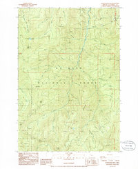
1985 Map of Wanderers Peak
USGS Topo · Published 1986About this map
Mt Hood National Forest dominates this mid-1980s topographical study, revealing a landscape defined by industrial resource extraction and seasonal recreation. High-elevation points like Wanderers Peak and South Fork Mtn rise above a dense network of timber-access roads and numerous Quarries and Borrow Pits that suggest the intensive logging operations of the era. Water drainage follows a fabric-themed naming convention in the east, where Silk Creek, Calico Creek, Gingham Creek, and Worsted Creek all feed into Fish Creek. To the west, the South Fork Clackamas River carves through steep terrain near the Memaloose Campground and Memaloose Lake. This provisional survey preserves the precise locations of temporary heliports, such as Hap-81 78-36, which were critical for forest management and fire control during this period of the twentieth century.
Find a feature on this map
52 named features on this map. Tap any name to fly to it.
Don’t see what you’re looking for? This feature index may not catch every label — zoom into the map to look around manually.
Map Details
Editions of this 1985 Wanderers Peak Map
This is the sole edition of this map. No revisions or reprints were ever made.
Other maps of this area

1916 · Estacada
USGS Topo · 1:125,000

1929 · Mill City
USGS Topo · 1:125,000

1948 · Vancouver
USGS Topo · 1:250,000

1950 · Vancouver
USGS Topo · 1:250,000

1950 · Vancouver
USGS Topo · 1:250,000

1953 · Salem
USGS Topo · 1:250,000

1954 · Salem
USGS Topo · 1:250,000

1955 · Colton
USGS Topo · 1:62,500

1955 · Mill City
USGS Topo · 1:62,500

1956 · Fish Creek Mtn
USGS Topo · 1:62,500