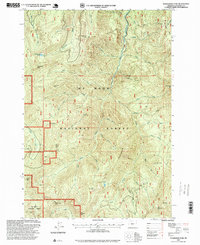
1997 Map of Wanderers Peak
USGS Topo · Published 1999About this map
Mt Hood National Forest dominates this section of the Oregon Cascades, where the South Fork Clackamas River and its numerous tributaries carve a complex drainage system through high-elevation terrain. This late-1990s survey illustrates a landscape primarily defined by forestry and resource extraction, evidenced by the numerous named quarries such as Deadhorse Quarry and Dunmarow Quarry scattered across the ridges. Higher peaks like Wanderers Peak and South Fork Mtn provide the topography for a network of named creeks, including the whimsically labeled Gingham Creek, Flannel Creek, and Tweed Creek. The presence of Memaloose Lake and Surprise Lake offers insight into the natural hydrology of these volcanic uplands, while the Fish Creek Divide serves as a significant geographic boundary on the eastern edge of the quadrangle, where extraction sites like Whalehead Quarry are situated.
Find a feature on this map
48 named features on this map. Tap any name to fly to it.
Don’t see what you’re looking for? This feature index may not catch every label — zoom into the map to look around manually.
Map Details
Editions of this 1997 Wanderers Peak Map
This is the sole edition of this map. No revisions or reprints were ever made.
Other maps of this area

1916 · Estacada
USGS Topo · 1:125,000

1929 · Mill City
USGS Topo · 1:125,000

1948 · Vancouver
USGS Topo · 1:250,000

1950 · Vancouver
USGS Topo · 1:250,000

1950 · Vancouver
USGS Topo · 1:250,000

1953 · Salem
USGS Topo · 1:250,000

1954 · Salem
USGS Topo · 1:250,000

1955 · Colton
USGS Topo · 1:62,500

1955 · Mill City
USGS Topo · 1:62,500

1956 · Fish Creek Mtn
USGS Topo · 1:62,500