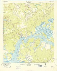
1943 Map of Wando
USGS Topo · Published 1943About this map
Wando River dominates this coastal South Carolina landscape, carving a wide path through the marshlands and tidal creeks of Berkeley and Charleston Counties. The settlement at Wando and the neighboring community of Cainhoy sit at a strategic point where land routes meet the water, supported by sites like Martins Point Landing and Lachicotte Landing. This survey reveals a transition from the water-based transport of the Lowcountry to overland rail, evidenced by the Lumber Railroad cutting through the interior forests north of the river.
Find a feature on this map
33 named features on this map. Tap any name to fly to it.
Don’t see what you’re looking for? This feature index may not catch every label — zoom into the map to look around manually.
Map Details
Editions of this 1943 Wando Map
3 editions found

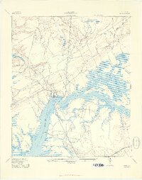
Other maps of this area

1919 · Capers Island
USGS Topo · 1:21,120

1919 · Wando
USGS Topo · 1:21,120

1919 · Cordesville
USGS Topo · 1:48,000

1919 · Melgrove
USGS Topo · 1:21,120

1919 · Charleston
USGS Topo · 1:21,120

1919 · Fort Moultrie
USGS Topo · 1:21,120

1919 · Sewee Bay
USGS Topo · 1:21,120

1940 · Melgrove
USGS Topo · 1:24,000

1943 · Capers Island
USGS Topo · 1:24,000

1943 · Fort Moultrie
USGS Topo · 1:24,000