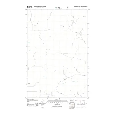
2011 Map of Wannagan Creek West
USGS Topo · Published 2011About this map
Lohman Ranch and Brown Ranch stand as prominent markers of the rural ranching culture in Billings County. This landscape is defined by the complex drainage system of Wannagan Creek and its tributaries, including Little Wannagan Creek and Winter Creek, which carve through the terrain. The topography is anchored by the elevation of East Twin Butte in the southwest, providing a natural landmark overlooking the creek beds. A network of local routes such as Belle Lake Rd, Westerheim Rd, and Wannagan Rd provides access to these isolated ranch sites, reflecting a sparse settlement pattern where roads follow the contours of the land and watercourses like Crooked Creek.
Find a feature on this map
27 named features on this map. Tap any name to fly to it.
Don’t see what you’re looking for? This feature index may not catch every label — zoom into the map to look around manually.
Map Details
Editions of this 2011 Wannagan Creek West Map
This is the sole edition of this map. No revisions or reprints were ever made.
Other maps of this area

1953 · Dickinson
USGS Topo · 1:250,000

1953 · Watford City
USGS Topo · 1:250,000

1957 · Dickinson
USGS Topo · 1:250,000

1957 · Watford City
USGS Topo · 1:250,000

1967 · Watford City
USGS Topo · 1:250,000

1970 · Wannagan Creek East
USGS Topo · 1:24,000

1970 · Roosevelt Creek East
USGS Topo · 1:24,000

1970 · Medora
USGS Topo · 1:24,000

1974 · West Twin Butte
USGS Topo · 1:24,000

1974 · Roosevelt Creek West
USGS Topo · 1:24,000