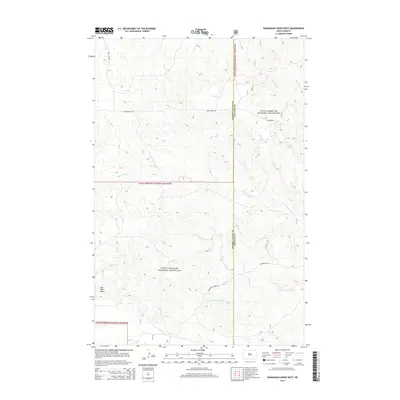
2014 Map of Wannagan Creek West
USGS Topo · Published 2014About this map
Little Missouri National Grassland dominates this western North Dakota landscape, showing a complex network of ephemeral drainages and high plains topography. The map defines the border between Golden Valley and Billings counties, a region where water sources like Roselle Spring were historically vital for land use. Significant waterways including Wannagan Cr, Crooked Cr, and Winter Cr carve through the terrain, illustrating the natural erosion patterns of the badlands vicinity. Distinctive landforms such as East Twin Butte provide clear navigational landmarks. The sparse infrastructure is limited to secondary routes like Westerheim Rd and Wannagan Creek Rd, reflecting the open, unpopulated character of this protected prairie environment in the early 21st century.
Find a feature on this map
13 named features on this map. Tap any name to fly to it.
Don’t see what you’re looking for? This feature index may not catch every label — zoom into the map to look around manually.
Map Details
Editions of this 2014 Wannagan Creek West Map
This is the sole edition of this map. No revisions or reprints were ever made.
Other maps of this area

1953 · Dickinson
USGS Topo · 1:250,000

1953 · Watford City
USGS Topo · 1:250,000

1957 · Dickinson
USGS Topo · 1:250,000

1957 · Watford City
USGS Topo · 1:250,000

1967 · Watford City
USGS Topo · 1:250,000

1970 · Wannagan Creek East
USGS Topo · 1:24,000

1970 · Roosevelt Creek East
USGS Topo · 1:24,000

1970 · Medora
USGS Topo · 1:24,000

1974 · West Twin Butte
USGS Topo · 1:24,000

1974 · Roosevelt Creek West
USGS Topo · 1:24,000