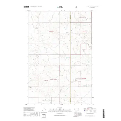
2017 Map of Wannagan Creek West
USGS Topo · Published 2017About this map
Little Missouri National Grassland dominates this section of the North Dakota badlands, where the drainage basins of Wannagan Creek and Little Wannagan Cr carve through the high plains. The terrain is defined by its seasonal watercourses, including Winter Cr and Crooked Cr, which underscore the arid character of the western ranchlands. Historical family presence is marked by the Lohmann Cem located near Westerheim Rd, serving as a genealogical anchor for the early settlers of this sparsely populated region. A network of primitive roads, such as Wannagan Creek Rd and Belle Lake Rd, traces the section lines across the boundary of Golden Valley Co and Billings Co, illustrating the intersection of public land management and local transit in the late 2010s.
Find a feature on this map
18 named features on this map. Tap any name to fly to it.
Don’t see what you’re looking for? This feature index may not catch every label — zoom into the map to look around manually.
Map Details
Editions of this 2017 Wannagan Creek West Map
This is the sole edition of this map. No revisions or reprints were ever made.
Other maps of this area

1953 · Dickinson
USGS Topo · 1:250,000

1953 · Watford City
USGS Topo · 1:250,000

1957 · Dickinson
USGS Topo · 1:250,000

1957 · Watford City
USGS Topo · 1:250,000

1967 · Watford City
USGS Topo · 1:250,000

1970 · Wannagan Creek East
USGS Topo · 1:24,000

1970 · Roosevelt Creek East
USGS Topo · 1:24,000

1970 · Medora
USGS Topo · 1:24,000

1974 · West Twin Butte
USGS Topo · 1:24,000

1974 · Roosevelt Creek West
USGS Topo · 1:24,000