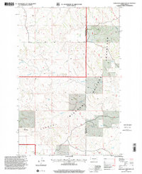
1997 Map of Wannagan Creek West
USGS Topo · Published 2001About this map
Little Missouri National Grassland dominates this landscape in western North Dakota, where the drainages of Wannagan Creek and Little Wannagan Creek carve through the high plains. Revised in the late 1990s by the USDA Forest Service, the map highlights the intricate relationship between water and the cattle-grazing economy of the Badlands, evidenced by scattered improvements like Roselle Spring and several unnamed Wells. The topography is defined by significant landmarks such as East Twin Butte, while the rugged path of the Maah Hey Dahl Trail winds across the eastern sections. This survey provides an essential view of the boundary between Golden Valley and Billings counties, capturing a network of unimproved roads and seasonal waterways like Winter Creek that sustain this high-desert environment.
Find a feature on this map
12 named features on this map. Tap any name to fly to it.
Don’t see what you’re looking for? This feature index may not catch every label — zoom into the map to look around manually.
Map Details
Editions of this 1997 Wannagan Creek West Map
This is the sole edition of this map. No revisions or reprints were ever made.
Other maps of this area

1953 · Dickinson
USGS Topo · 1:250,000

1953 · Watford City
USGS Topo · 1:250,000

1957 · Dickinson
USGS Topo · 1:250,000

1957 · Watford City
USGS Topo · 1:250,000

1967 · Watford City
USGS Topo · 1:250,000

1970 · Wannagan Creek East
USGS Topo · 1:24,000

1970 · Roosevelt Creek East
USGS Topo · 1:24,000

1970 · Medora
USGS Topo · 1:24,000

1974 · West Twin Butte
USGS Topo · 1:24,000

1974 · Roosevelt Creek West
USGS Topo · 1:24,000