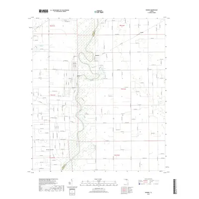
2018 Map of Wannee
USGS Topo · Published 2018About this map
The Suwannee River carves a winding path along the boundary of Dixie and Gilchrist counties, anchoring a landscape defined by its freshwater springs and riverside hamlets. The settlement of Wannee and the elevated ground at McMillan Bluff overlook the river's eastern banks, while several named springs—including Sun Springs, Lumber Camp Springs, and Hart Springs—surface throughout the local karst topography. Genealogy researchers will find significant markers of local history at the Fayetteville Cem and McCrabb Cem, which serve as early cornerstones for the rural communities of this river valley. The map further documents small residential developments like Old Town Hammock and Katelyn Ests, set against the low-lying terrain of Beason Prairie to the northwest.
Find a feature on this map
189 named features on this map. Tap any name to fly to it.
Don’t see what you’re looking for? This feature index may not catch every label — zoom into the map to look around manually.
Map Details
Editions of this 2018 Wannee Map
This is the sole edition of this map. No revisions or reprints were ever made.
Other maps of this area

1954 · Eugene
USGS Topo · 1:24,000

1954 · Cross City East
USGS Topo · 1:24,000

1954 · Mallory Swamp SE
USGS Topo · 1:24,000

1954 · Gainesville
USGS Topo · 1:250,000

1956 · Mallory Swamp SE
USGS Topo · 1:25,000

1958 · Gainesville
USGS Topo · 1:250,000

1959 · Gainesville
USGS Topo · 1:250,000

1968 · Fourmile Lake
USGS Topo · 1:24,000

1968 · Hatchbend
USGS Topo · 1:24,000

1968 · Trenton
USGS Topo · 1:24,000