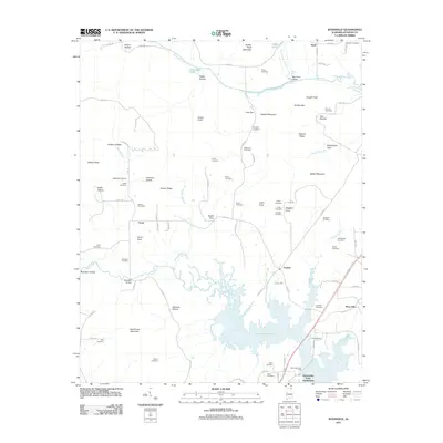
2011 Map of Wannville
USGS Topo · Published 2011About this map
Guntersville Lake and the winding course of Big Coon Creek dominate the landscape of Jackson County, where the Tennessee River's reach meets the rising elevations of the Cumberland Plateau foothills. This area is characterized by numerous small, family-named coves and hollows, including Roach Cove, Carns Cove, and Stogsdill Cove, reflecting a long history of local settlement and land use. The map reveals a dense concentration of historical burial sites, such as the Pauper Cemetery, Rorex Cemetery, and Lovelady Cemetery, which provide valuable data for genealogists tracing families in the Wannville and Fackler vicinities. Transportation and water access remain central to the area's layout, evidenced by the Renshaw Bridge spanning Mud Creek and the Mud Creek Boat Dock serving the growing Nacoochee Point Subdivision along the lake's edge.
Find a feature on this map
102 named features on this map. Tap any name to fly to it.
Don’t see what you’re looking for? This feature index may not catch every label — zoom into the map to look around manually.
Map Details
Editions of this 2011 Wannville Map
This is the sole edition of this map. No revisions or reprints were ever made.
Other maps of this area

1886 · Stevenson
USGS Topo · 1:125,000

1888 · Scottsboro
USGS Topo · 1:125,000

1892 · Scottsboro
USGS Topo · 1:125,000

1892 · Stevenson
USGS Topo · 1:125,000

1895 · Stevenson
USGS Topo · 1:125,000

1936 · Scottsboro
USGS Topo · 1:24,000

1936 · Wannville
USGS Topo · 1:24,000

1936 · Mud Creek
USGS Topo · 1:24,000

1936 · Hytop
USGS Topo · 1:24,000

1936 · Hollywood
USGS Topo · 1:24,000