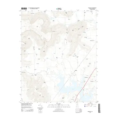
2014 Map of Wannville
USGS Topo · Published 2014About this map
Guntersville Lake and the Tennessee River valley define the southeastern portion of this landscape, where the settlements of Stevenson and Wannville anchor the local geography. The terrain transitions from the lowlands near Backbone Ridge to the elevated plateaus and deep hollows of the northern section, such as Big Coon Valley and Goshen Hollow. This 2014 survey reveals a dense network of family and community landmarks, particularly evident in the high concentration of burial grounds like Shipp Cem, Pauper Cem, and Stogspill Cem. The presence of Renshaw Bridge over Mud Creek and various named points like Russell Point and Indian Point illustrates how historical transport and natural topography shaped the development of communities like Fackler and Rash. Significant relief is shown across Crow Mtn and Russell Mtn, highlighting the divide between the river flats and the upland ridge system.
Find a feature on this map
101 named features on this map. Tap any name to fly to it.
Don’t see what you’re looking for? This feature index may not catch every label — zoom into the map to look around manually.
Map Details
Editions of this 2014 Wannville Map
This is the sole edition of this map. No revisions or reprints were ever made.
Other maps of this area

1886 · Stevenson
USGS Topo · 1:125,000

1888 · Scottsboro
USGS Topo · 1:125,000

1892 · Scottsboro
USGS Topo · 1:125,000

1892 · Stevenson
USGS Topo · 1:125,000

1895 · Stevenson
USGS Topo · 1:125,000

1936 · Scottsboro
USGS Topo · 1:24,000

1936 · Wannville
USGS Topo · 1:24,000

1936 · Mud Creek
USGS Topo · 1:24,000

1936 · Hytop
USGS Topo · 1:24,000

1936 · Hollywood
USGS Topo · 1:24,000