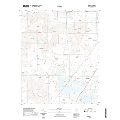
2020 Map of Wannville
USGS Topo · Published 2020About this map
Guntersville Lake and its intricate wetlands dominate the southern landscape of this Jackson County region, where the terrain transitions from the broad waters of the Tennessee River valley into the sharp ridges and deep coves of the Cumberland Plateau. The settlement of Stevenson serves as a local hub, flanked by the smaller communities of Fackler, Hollywood, and Wannville. The geography is defined by a series of "hollows" and "coves," such as Roach Cove and Brewster Hollow, which historically dictated the movement of people and the placement of small family cemeteries. Numerous burial sites, including the Pauper Cem near Mill Hollow and the Wrights Chapel Cem, provide essential data for genealogical research. To the north, Big Coon Creek winds through Big Coon Valley, carved between prominent heights like Dudley Pond Mtn and Crow Mtn.
Find a feature on this map
116 named features on this map. Tap any name to fly to it.
Don’t see what you’re looking for? This feature index may not catch every label — zoom into the map to look around manually.
Map Details
Editions of this 2020 Wannville Map
This is the sole edition of this map. No revisions or reprints were ever made.
Other maps of this area

1886 · Stevenson
USGS Topo · 1:125,000

1888 · Scottsboro
USGS Topo · 1:125,000

1892 · Scottsboro
USGS Topo · 1:125,000

1892 · Stevenson
USGS Topo · 1:125,000

1895 · Stevenson
USGS Topo · 1:125,000

1936 · Scottsboro
USGS Topo · 1:24,000

1936 · Wannville
USGS Topo · 1:24,000

1936 · Mud Creek
USGS Topo · 1:24,000

1936 · Hytop
USGS Topo · 1:24,000

1936 · Hollywood
USGS Topo · 1:24,000