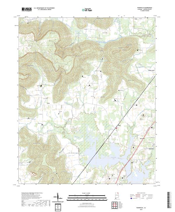
2024 Map of Wannville
USGS Topo · Published 2024About this map
Guntersville Lake dominates the southern reaches of this Jackson County landscape, where the waters of Mud Creek and Blue Spring Brook meet the Tennessee River drainage. The map reveals a heavily dissected topography defined by the massive ridges of Crow Mtn, Dudley Pond Mtn, and Poorhouse Mtn, which separate the agricultural lowlands of Big Coon Valley and Washington Cove. This modern survey is a vital resource for genealogists, documenting a high density of small family and community burial grounds including the Old Tate Farm Cem, Lovelady Cem, and Shipp Cem. The settlement pattern follows the terrain, with small clusters at Fackler, Stevenson, and Wannville situated along the primary transport corridors like the John T Reid Pkwy, while more isolated valley settlements like Carns remain tucked into the protected coves.
Find a feature on this map
107 named features on this map. Tap any name to fly to it.
Don’t see what you’re looking for? This feature index may not catch every label — zoom into the map to look around manually.
Map Details
Editions of this 2024 Wannville Map
This is the sole edition of this map. No revisions or reprints were ever made.
Other maps of this area

1886 · Stevenson
USGS Topo · 1:125,000

1888 · Scottsboro
USGS Topo · 1:125,000

1892 · Scottsboro
USGS Topo · 1:125,000

1892 · Stevenson
USGS Topo · 1:125,000

1895 · Stevenson
USGS Topo · 1:125,000

1936 · Scottsboro
USGS Topo · 1:24,000

1936 · Wannville
USGS Topo · 1:24,000

1936 · Mud Creek
USGS Topo · 1:24,000

1936 · Hytop
USGS Topo · 1:24,000

1936 · Hollywood
USGS Topo · 1:24,000