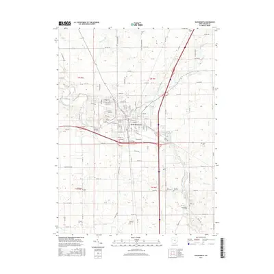
2016 Map of Wapakoneta
USGS Topo · Published 2016About this map
Wapakoneta serves as the focal point of this Auglaize County landscape, where the Auglaize River winds through the northern reaches of the township. The 2016 survey detail illustrates a mature network of section roads and regional thoroughfares, such as the Wapakoneta Cridersville Rd and Blank Pike, that connect the city to outlying rural areas like Fryburg. This documentation is particularly valuable for genealogical research, as it identifies numerous family and community burial grounds including Old Saint Josephs Cem, Greenlawn Cem, and Hittepole Cem. The drainage patterns of Pusheta Cr and Eagle Cr define the local topography, while smaller waterways like Quaker Run and Dry Run snake through the agricultural sections. The map reveals the modern intersection of interstate infrastructure with long-established property lines and legacy watercourses, documenting the persistent layout of western Ohio’s rural and urban landscape.
Find a feature on this map
150 named features on this map. Tap any name to fly to it.
Don’t see what you’re looking for? This feature index may not catch every label — zoom into the map to look around manually.
Map Details
Editions of this 2016 Wapakoneta Map
This is the sole edition of this map. No revisions or reprints were ever made.
Other maps of this area

1906 · Lima
USGS Topo · 1:62,500

1909 · Loramie
USGS Topo · 1:62,500

1911 · Loramie
USGS Topo · 1:62,500

1911 · Spencerville
USGS Topo · 1:62,500

1913 · Sidney
USGS Topo · 1:62,500

1944 · Sidney
USGS Topo · 1:62,500

1944 · Loramie
USGS Topo · 1:62,500

1944 · Spencerville
USGS Topo · 1:62,500

1953 · Muncie
USGS Topo · 1:250,000

1956 · Muncie
USGS Topo · 1:250,000