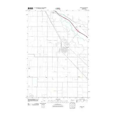
2011 Map of Wapato
USGS Topo · Published 2011About this map
Wapato serves as the primary hub in this portion of the Yakima Valley, where a grid of rural roads and irrigation infrastructure supports the region's agricultural character. The Yakima River snakes across the northern landscape, its flow managed by the Sunnyside Dam and channeled into the Union Gap Canal. This intricate water system is vital to the surrounding settlements of Ashue, Venner, and Utahco, which are interspersed among a network of family-named lanes and frontage roads. The presence of the Parker Heights Grange near the community of Donald highlights the enduring importance of local agricultural associations. Notable water features like Wanity Slough parallel the river, illustrating the natural drainage patterns that have shaped the development of these central Washington communities during the early twenty-first century.
Find a feature on this map
82 named features on this map. Tap any name to fly to it.
Don’t see what you’re looking for? This feature index may not catch every label — zoom into the map to look around manually.
Map Details
Editions of this 2011 Wapato Map
This is the sole edition of this map. No revisions or reprints were ever made.
Other maps of this area

1899 · Ellensburg
USGS Topo · 1:125,000

1901 · Ellensburg
USGS Topo · 1:125,000

1910 · Zillah
USGS Topo · 1:125,000

1936 · Yakima East
USGS Topo · 1:48,000

1937 · White Swan
USGS Topo · 1:125,000

1941 · Yakima East
USGS Topo · 1:62,500

1950 · Yakima
USGS Topo · 1:250,000

1953 · Elephant Mountain
USGS Topo · 1:24,000

1953 · Yakima East
USGS Topo · 1:24,000
1953 · Yakima East
USGS Topo · 1:62,500