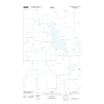
2013 Map of Wapogasset Lake
USGS Topo · Published 2013About this map
Wapogasset Lake and Bear Trap Lake dominate this Wisconsin landscape, where a complex network of glacial water bodies is interconnected by the Apple River and its various tributaries. The 2013 survey shows a region defined by its waterfront geography, with numerous residential roads such as Sunrise Beach Dr, Marina Dr, and Hickory Point Ln tracing the irregular shorelines of the larger lakes. This period reflects the established recreational and residential character of the area, with the Amery Municipal Airport serving as a local transportation hub in the southeast.
Find a feature on this map
77 named features on this map. Tap any name to fly to it.
Don’t see what you’re looking for? This feature index may not catch every label — zoom into the map to look around manually.
Map Details
Editions of this 2013 Wapogasset Lake Map
This is the sole edition of this map. No revisions or reprints were ever made.
Other maps of this area

1900 · St Croix Dalles
USGS Topo · 1:62,500

1901 · St Croix Dalles
USGS Topo · 1:62,500

1948 · New Richmond
USGS Topo · 1:62,500

1949 · New Richmond
USGS Topo · 1:62,500

1950 · Deer Park
USGS Topo · 1:62,500

1950 · Balsam Lake
USGS Topo · 1:62,500

1953 · Stillwater
USGS Topo · 1:250,000

1955 · St. Croix Dalles
USGS Topo · 1:62,500

1955 · Stillwater
USGS Topo · 1:250,000

1958 · Stillwater
USGS Topo · 1:250,000