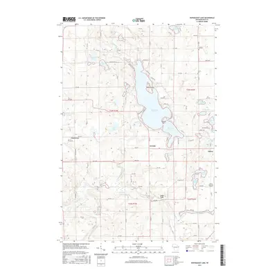
2015 Map of Wapogasset Lake
USGS Topo · Published 2015About this map
Wapogasset Lake and its surrounding glacial terrain dominate this portion of Polk County, where the Apple River and Wapogasset Branch create a complex network of waterways. The landscape is dotted with smaller basins such as Bear Trap Lake, Goose Lake, and Ox Lake, many of which are linked by seasonal streams or low-lying wetlands. Human settlement is concentrated in small communities like Deronda, Wanderoos, and the northern edge of Amery. Genealogists may find value in the locations of Travelers Rest Cem and Lincoln Cem, while the inclusion of the Amery Municipal Airport and the damming at Black Brook Flowage reflects the 21st-century infrastructure supporting this recreation-heavy region. The grid of county highways and local roads like Lone Pine Ln and Sunrise Beach Dr illustrates the dense development of lakeside properties and agricultural parcels.
Find a feature on this map
79 named features on this map. Tap any name to fly to it.
Don’t see what you’re looking for? This feature index may not catch every label — zoom into the map to look around manually.
Map Details
Editions of this 2015 Wapogasset Lake Map
This is the sole edition of this map. No revisions or reprints were ever made.
Other maps of this area

1900 · St Croix Dalles
USGS Topo · 1:62,500

1901 · St Croix Dalles
USGS Topo · 1:62,500

1948 · New Richmond
USGS Topo · 1:62,500

1949 · New Richmond
USGS Topo · 1:62,500

1950 · Deer Park
USGS Topo · 1:62,500

1950 · Balsam Lake
USGS Topo · 1:62,500

1953 · Stillwater
USGS Topo · 1:250,000

1955 · St. Croix Dalles
USGS Topo · 1:62,500

1955 · Stillwater
USGS Topo · 1:250,000

1958 · Stillwater
USGS Topo · 1:250,000