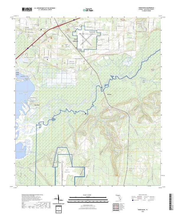
2024 Map of Ward Basin
USGS Topo · Published 2024About this map
The Yellow River and its complex network of oxbows and backwaters, including Dead River and Plank Bridge Lake, dominate this landscape east of the Blackwater Bay. Settlement is concentrated in East Milton, while the southern and eastern portions of the map are defined by the extensive military reservations of Eglin Air Force Base. Genealogists will find several notable burial grounds, such as Welcome Cem, Friendship Cem, and the Lewis Williams Memorial Cem near the river bluffs. The map captures the transition from the residential street grids of East Milton to the more isolated communities of Pine Bluff and Broxson. Significant aviation infrastructure is also evident through the Santa Rosa Naval Outlying Field and Choctaw Naval Outlying Field, reflecting the area's strategic role in regional defense and naval training.
Find a feature on this map
141 named features on this map. Tap any name to fly to it.
Don’t see what you’re looking for? This feature index may not catch every label — zoom into the map to look around manually.
Map Details
Editions of this 2024 Ward Basin Map
This is the sole edition of this map. No revisions or reprints were ever made.
Other maps of this area

1920 · Milton
USGS Topo · 1:62,500

1921 · Holley
USGS Topo · 1:62,500

1921 · Pensacola
USGS Topo · 1:62,500

1934 · Harold
USGS Topo · 1:62,500

1936 · Holley
USGS Topo · 1:48,000

1937 · Harold
USGS Topo · 1:62,500

1938 · Holley
USGS Topo · 1:62,500

1938 · Harold
USGS Topo · 1:62,500

1941 · Pensacola
USGS Topo · 1:62,500

1941 · Milton
USGS Topo · 1:62,500