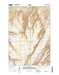
2017 Map of Ward Butte
USGS Topo · Published 2017About this map
Ward Butte and the winding course of Butter Cr define this high plateau landscape on the border of Morrow and Umatilla counties. In the early 21st century, this region remains characterized by wide-open ranching and agricultural operations, as evidenced by naming conventions for thoroughfares like McCarty Ranch Ln, Mader Rust Ln, and Eagle Ranch Rd. The presence of the West Buttercreek Airport near Hwy 207 highlights the importance of private aviation for transport across these expansive distances. The terrain is marked by significant elevation changes, most notably at Fourmile Canyon and the distinctive peak of Ward Butte itself. Historical transportation routes are preserved in the naming of Wagon Trail Rd in the southwestern corner, offering a glimpse into the earlier surveying and travel patterns across these Oregon uplands.
Find a feature on this map
16 named features on this map. Tap any name to fly to it.
Don’t see what you’re looking for? This feature index may not catch every label — zoom into the map to look around manually.
Map Details
Editions of this 2017 Ward Butte Map
This is the sole edition of this map. No revisions or reprints were ever made.
Other maps of this area

1906 · Blalock Island
USGS Topo · 1:125,000

1908 · Blalock Island
USGS Topo · 1:125,000

1908 · Umatilla
USGS Topo · 1:125,000

1953 · Pendleton
USGS Topo · 1:250,000

1956 · Pendleton
USGS Topo · 1:250,000

1962 · Ordnance
USGS Topo · 1:24,000

1962 · Hermiston
USGS Topo · 1:24,000

1962 · Clarke
USGS Topo · 1:24,000

1968 · Service Buttes NW
USGS Topo · 1:24,000

1968 · Vey Ranch
USGS Topo · 1:24,000