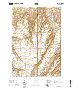
2020 Map of Ward Butte
USGS Topo · Published 2020About this map
Ward Butte rises above the eastern high desert of Oregon, marking a landscape defined by deep canyons and seasonal drainage systems. The Morrow and Umatilla County line bisects this 2020 survey, which documents the remote ranching and aviation infrastructure of the region. The map tracks the winding course of Butter Cr as it flows north, parallel to the Hwy 207 corridor. Aviation history and modern transport are represented by the West Buttercreek Airport, situated near the intersection of several rural routes. Local land use is further illustrated by family-named landmarks and access ways like McCarty Ranch Ln and Mader Rust Ln. The presence of the Wagon Trail Rd in the southwest corner suggests the persistent influence of historical movement patterns through Fourmile Canyon and across the ridgelines.
Find a feature on this map
17 named features on this map. Tap any name to fly to it.
Don’t see what you’re looking for? This feature index may not catch every label — zoom into the map to look around manually.
Map Details
Editions of this 2020 Ward Butte Map
This is the sole edition of this map. No revisions or reprints were ever made.
Other maps of this area

1906 · Blalock Island
USGS Topo · 1:125,000

1908 · Blalock Island
USGS Topo · 1:125,000

1908 · Umatilla
USGS Topo · 1:125,000

1953 · Pendleton
USGS Topo · 1:250,000

1956 · Pendleton
USGS Topo · 1:250,000

1962 · Ordnance
USGS Topo · 1:24,000

1962 · Hermiston
USGS Topo · 1:24,000

1962 · Clarke
USGS Topo · 1:24,000

1968 · Service Buttes NW
USGS Topo · 1:24,000

1968 · Vey Ranch
USGS Topo · 1:24,000