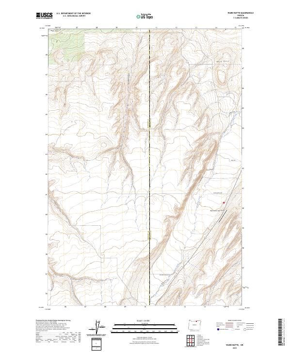
2023 Map of Ward Butte
USGS Topo · Published 2023About this map
Ward Butte rises as a prominent landmark in this eastern Oregon landscape, where the boundary between Morrow Co and Umatilla Co bisects the terrain. The drainage of Butter Creek carves through the eastern portion of the quadrangle, creating a focal point for local transport and infrastructure. Nearby, the West Buttercreek Airport serves the surrounding ranching community, while the deep incision of Fourmile Canyon defines the central topography. The map reveals a network of rural access points including Madison Rd and Cochran Rd, alongside family-named landmarks like McCarty Ranch Ln and Mader Rust Ln. A historic connection to the region's pioneering past is visible in the presence of Wagon Trail Rd in the southwest, tracing an older route through the high desert landscape just west of the county line.
Find a feature on this map
16 named features on this map. Tap any name to fly to it.
Don’t see what you’re looking for? This feature index may not catch every label — zoom into the map to look around manually.
Map Details
Editions of this 2023 Ward Butte Map
This is the sole edition of this map. No revisions or reprints were ever made.
Other maps of this area

1906 · Blalock Island
USGS Topo · 1:125,000

1908 · Blalock Island
USGS Topo · 1:125,000

1908 · Umatilla
USGS Topo · 1:125,000

1953 · Pendleton
USGS Topo · 1:250,000

1956 · Pendleton
USGS Topo · 1:250,000

1962 · Ordnance
USGS Topo · 1:24,000

1962 · Hermiston
USGS Topo · 1:24,000

1962 · Clarke
USGS Topo · 1:24,000

1968 · Service Buttes NW
USGS Topo · 1:24,000

1968 · Vey Ranch
USGS Topo · 1:24,000