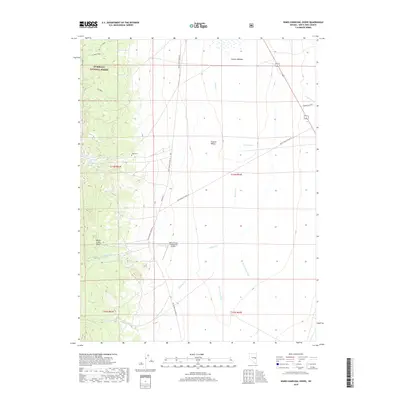
2018 Map of Ward Charcoal Ovens
USGS Topo · Published 2018About this map
Steptoe Valley forms the central basin of this high-altitude landscape, where the transition from desert floor to the Humboldt National Forest is marked by a network of drainage washes and ephemeral springs. Traces of the region's mining and ranching heritage are preserved in the presence of the Ward Cem and the S E Ward Trail, which cuts through the foothills of the Egan Range. Water is a defining element for this arid corridor, evidenced by Willow Creek Basin and Comins Meadow, which collect seasonal runoff from the higher elevations. The infrastructure of the modern era is represented by the Willow Creek Trading Post Airport, situated near White Pine Co Road 45, serving as a critical navigation point in this sparsely populated portion of White Pine County.
Find a feature on this map
26 named features on this map. Tap any name to fly to it.
Don’t see what you’re looking for? This feature index may not catch every label — zoom into the map to look around manually.
Map Details
Editions of this 2018 Ward Charcoal Ovens Map
This is the sole edition of this map. No revisions or reprints were ever made.
Other maps of this area

1952 · Ely
USGS Topo · 1:125,000

1956 · Lund
USGS Topo · 1:250,000

1956 · Ely
USGS Topo · 1:250,000

1958 · Comins Lake
USGS Topo · 1:24,000

1958 · Ely
USGS Topo · 1:62,500

1958 · Ely
USGS Topo · 1:24,000

1959 · Ely
USGS Topo · 1:250,000

1959 · Connors Pass
USGS Topo · 1:62,500

1960 · Lund
USGS Topo · 1:250,000

1963 · Ely
USGS Topo · 1:250,000