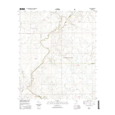
2015 Map of Ward
USGS Topo · Published 2015About this map
Apalachicola National Forest dominates this section of the Florida Panhandle, where the tri-county border of Liberty, Leon, and Wakulla counties meets. The landscape is defined by a complex network of waterways, including the winding Telogia Creek, the headwaters of the W Br Sopchoppy River, and several family-named drainage runs such as Culley Br and Camp Br. The settlement of Ward sits near the center of the sheet, while family history is rooted at Chason Cemetery in the southwest and near Rhodes Springs to the east.
Find a feature on this map
52 named features on this map. Tap any name to fly to it.
Don’t see what you’re looking for? This feature index may not catch every label — zoom into the map to look around manually.
Map Details
Editions of this 2015 Ward Map
This is the sole edition of this map. No revisions or reprints were ever made.
Other maps of this area

1943 · Lake Talquin
USGS Topo · 1:62,500

1944 · Queens Bay
USGS Topo · 1:24,000

1945 · Smith Creek
USGS Topo · 1:31,680

1945 · Bradwell Bay
USGS Topo · 1:31,680

1945 · Hosford
USGS Topo · 1:31,680

1945 · Telogia
USGS Topo · 1:24,000

1946 · Queens Bay
USGS Topo · 1:31,680

1946 · Telogia
USGS Topo · 1:31,680

1954 · Tallahassee
USGS Topo · 1:250,000

1959 · Tallahassee
USGS Topo · 1:250,000