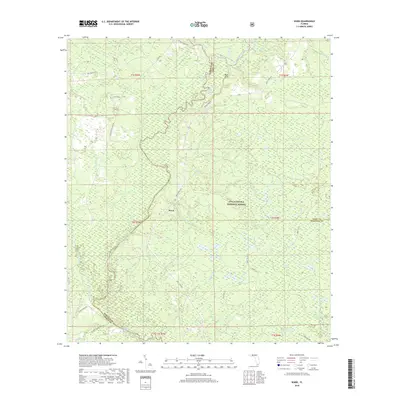
2018 Map of Ward
USGS Topo · Published 2018About this map
The Ochlockonee River meanders through the heart of this region, defining the borders between Leon, Liberty, and Wakulla Counties. Much of the landscape is contained within the Apalachicola National Forest, characterized by an extensive network of tributaries such as Sweetwater Cr and Caney Cr. The settlement of Ward sits central to this wooded terrain, which is punctuated by significant wetlands and water bodies including Gulley Bay, Long Bay, and the spring-fed waters of Rhodes Springs.
Find a feature on this map
47 named features on this map. Tap any name to fly to it.
Don’t see what you’re looking for? This feature index may not catch every label — zoom into the map to look around manually.
Map Details
Editions of this 2018 Ward Map
This is the sole edition of this map. No revisions or reprints were ever made.
Other maps of this area

1943 · Lake Talquin
USGS Topo · 1:62,500

1944 · Queens Bay
USGS Topo · 1:24,000

1945 · Smith Creek
USGS Topo · 1:31,680

1945 · Bradwell Bay
USGS Topo · 1:31,680

1945 · Hosford
USGS Topo · 1:31,680

1945 · Telogia
USGS Topo · 1:24,000

1946 · Queens Bay
USGS Topo · 1:31,680

1946 · Telogia
USGS Topo · 1:31,680

1954 · Tallahassee
USGS Topo · 1:250,000

1959 · Tallahassee
USGS Topo · 1:250,000