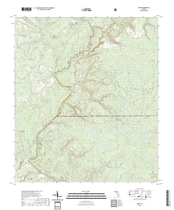
2024 Map of Ward
USGS Topo · Published 2024About this map
The Ochlockonee River forms the eastern boundary of this landscape, winding past Rock Bluff and the pools of Round Pond and Long Pond. Much of the terrain is defined by the Apalachicola National Forest, where a network of forest roads and creek systems like Telogia Creek and Sweetwater Creek dominate the geography. For genealogists, the map is remarkably dense with family-named landmarks and burial sites, including the Stoutamire Family Cem, Duggar Family Cem, and the long-titled Olin Thomas and June Bowen Stoutamire Family Cem. The small settlement of Ward sits at a crossroads of several routes, while the northern reaches are marked by the Blue Creek Methodist Church Cem. The southern area is equally rich in local history, featuring the Good Hope Cem and Chason Cem near the banks of Fox Branch.
Find a feature on this map
55 named features on this map. Tap any name to fly to it.
Don’t see what you’re looking for? This feature index may not catch every label — zoom into the map to look around manually.
Map Details
Editions of this 2024 Ward Map
This is the sole edition of this map. No revisions or reprints were ever made.
Other maps of this area

1943 · Lake Talquin
USGS Topo · 1:62,500

1944 · Queens Bay
USGS Topo · 1:24,000

1945 · Smith Creek
USGS Topo · 1:31,680

1945 · Bradwell Bay
USGS Topo · 1:31,680

1945 · Hosford
USGS Topo · 1:31,680

1945 · Telogia
USGS Topo · 1:24,000

1946 · Queens Bay
USGS Topo · 1:31,680

1946 · Telogia
USGS Topo · 1:31,680

1954 · Tallahassee
USGS Topo · 1:250,000

1959 · Tallahassee
USGS Topo · 1:250,000