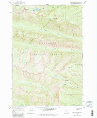
1964 Map of Ward Mountain
USGS Topo · Published 1984About this map
Bitterroot National Forest dominates this mid-1960s terrain, where high-altitude peaks and glacial lakes define the landscape of Ravalli County. The area is divided by a significant Wilderness Boundary that separates the general forest land from the Selway Bitterroot Wilderness, a designation reflecting the era's emerging conservation priorities. A remote Lookout Tower stands atop Ward Mountain, reached by the Ward Mountain Trail, serving as a vital sentinel for fire detection across the drainage basins of Roaring Lion Creek and Sawtooth Creek. The topography is exceptionally steep, characterized by dramatic drops such as Canyon Falls and isolated water bodies like Camas Lake and Kidney Lake. This map captures a pristine wilderness environment before modern digital mapping, where foot trails and lookout points were the primary means of navigating and monitoring the backcountry.
Find a feature on this map
27 named features on this map. Tap any name to fly to it.
Don’t see what you’re looking for? This feature index may not catch every label — zoom into the map to look around manually.
Map Details
Editions of this 1964 Ward Mountain Map
3 editions found
Other maps of this area

1901 · Hamilton
USGS Topo · 1:125,000

1956 · Hamilton
USGS Topo · 1:250,000

1959 · Hamilton
USGS Topo · 1:250,000

1960 · Hamilton
USGS Topo · 1:250,000

1964 · Hamilton
USGS Topo · 1:250,000

1964 · Hamilton South
USGS Topo · 1:24,000

1964 · Tenmile Lake
USGS Topo · 1:24,000

1964 · Darby
USGS Topo · 1:24,000

1964 · Ward Mountain
USGS Topo · 1:24,000
1964 · El Capitan
USGS Topo · 1:24,000