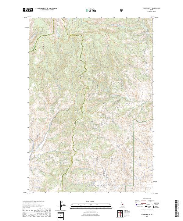
2024 Map of Wards Butte
USGS Topo · Published 2024About this map
Wards Butte stands as a central topographic landmark along the high-elevation boundary where the Challis National Forest meets the Salmon National Forest. This remote section of the Salmon River Mountains is defined by a dense network of drainages and timber management routes, with the county line between Lemhi and Custer counties tracing the high ridgelines. The map reveals an intricate system of forest trails, including the Iron Mountain Trl and the Big Hat Creek Trl, which provide access to deep canyons and seasonal watersheds. Named features such as Sawmill Creek and Burnt Gulch suggest a landscape shaped by historical resource extraction and the natural cycles of the Idaho wilderness. Larger watercourses like Big Hat Creek and Little Hat Creek dictate the local geography, flanked by rugged roads such as Morgan Creek Rd that navigate the steep terrain of the Frank Church region.
Find a feature on this map
34 named features on this map. Tap any name to fly to it.
Don’t see what you’re looking for? This feature index may not catch every label — zoom into the map to look around manually.
Map Details
Editions of this 2024 Wards Butte Map
This is the sole edition of this map. No revisions or reprints were ever made.
Other maps of this area

1956 · Challis
USGS Topo · 1:62,500

1956 · Twin Peaks
USGS Topo · 1:62,500

1957 · Challis
USGS Topo · 1:250,000

1960 · Challis
USGS Topo · 1:250,000
1962 · Degan Mtn
USGS Topo · 1:24,000

1963 · Challis
USGS Topo · 1:250,000
1963 · Opal Lake
USGS Topo · 1:24,000
1963 · Black Mtn
USGS Topo · 1:24,000
1963 · Taylor Mountain
USGS Topo · 1:24,000
1963 · Hat Creek
USGS Topo · 1:24,000