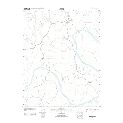
2011 Map of Wardsville
USGS Topo · Published 2011About this map
The Osage River meanders broadly through this central Missouri landscape, defining the character of the riverfront communities of Osage Bluff and Osage Bend. In the northern portion of the quadrangle, the town of Wardsville serves as a primary hub, situated near the Moreau River and Saint Stanislaus Cemetery. The terrain is marked by distinctive natural landmarks like Castle Rock and the extensive Honey Creek State Wildlife Area, which preserves the wetlands and timber surrounding its namesake Honey Creek.
Find a feature on this map
58 named features on this map. Tap any name to fly to it.
Don’t see what you’re looking for? This feature index may not catch every label — zoom into the map to look around manually.
Map Details
Editions of this 2011 Wardsville Map
This is the sole edition of this map. No revisions or reprints were ever made.
Other maps of this area

1886 · Jefferson City
USGS Topo · 1:125,000

1888 · Tuscumbia
USGS Topo · 1:125,000

1894 · Tuscumbia
USGS Topo · 1:125,000

1894 · Jefferson City
USGS Topo · 1:125,000

1939 · Jefferson City
USGS Topo · 1:24,000

1939 · Jefferson City
USGS Topo · 1:62,500

1942 · Jefferson City
USGS Topo · 1:62,500

1947 · Jefferson City
USGS Topo · 1:250,000

1948 · Centertown
USGS Topo · 1:62,500

1948 · Meta
USGS Topo · 1:62,500