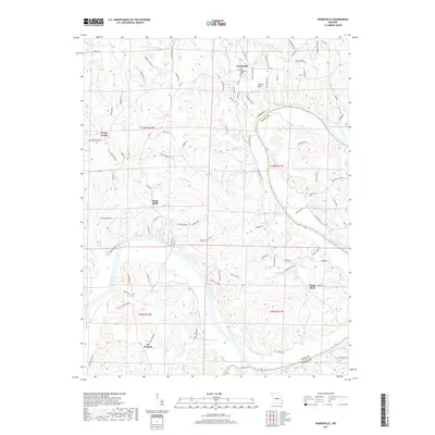
2017 Map of Wardsville
USGS Topo · Published 2017About this map
The Osage River and its winding tributaries define the landscape of this portion of Cole and Osage counties during the late 2010s. The settlement of Wardsville serves as a primary hub in the north, situated near the Saint Stanislaus Cem and the distinctive geological formation of Castle Rock. To the south, the community of St. Thomas anchors a terrain marked by deep ridges and creek valleys. This survey illustrates a complex network of rural roads such as Tanner Bridge Rd and Route W that follow the topography of the river bluffs. Small settlements like Honey Creek and Osage Bluff are interconnected by these routes, while numerous watercourses including Gum Spring Br and Moreau River cut through the high ground, showing the enduring influence of the river system on local habitation patterns.
Find a feature on this map
91 named features on this map. Tap any name to fly to it.
Don’t see what you’re looking for? This feature index may not catch every label — zoom into the map to look around manually.
Map Details
Editions of this 2017 Wardsville Map
This is the sole edition of this map. No revisions or reprints were ever made.
Other maps of this area

1886 · Jefferson City
USGS Topo · 1:125,000

1888 · Tuscumbia
USGS Topo · 1:125,000

1894 · Tuscumbia
USGS Topo · 1:125,000

1894 · Jefferson City
USGS Topo · 1:125,000

1939 · Jefferson City
USGS Topo · 1:24,000

1939 · Jefferson City
USGS Topo · 1:62,500

1942 · Jefferson City
USGS Topo · 1:62,500

1947 · Jefferson City
USGS Topo · 1:250,000

1948 · Centertown
USGS Topo · 1:62,500

1948 · Meta
USGS Topo · 1:62,500