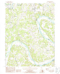
1987 Map of Wardsville
USGS Topo · Published 1988About this map
Osage River meanders through the central and eastern sections of this quadrangle, defining the agricultural and recreational character of central Missouri in the late 1980s. The settlement of Wardsville sits atop the northern highlands, while smaller locales like Honey Creek and Osage Bluff anchor the rural landscape. Significant conservation efforts are evident in the sprawling Honey Creek State Wildlife Area and Pikes Camp State Wildlife Area, which preserve the wooded bluffs and river bottoms. Geologic features such as the distinctive Castle Rock and the extensive Sand Area along the river banks highlight the area's natural topography. For local historians and genealogists, the placement of rural Cem sites and the mid-century infrastructure of the Wooden Pole Trans Line provide precise markers of the era's land use and community layout before further suburban expansion.
Find a feature on this map
33 named features on this map. Tap any name to fly to it.
Don’t see what you’re looking for? This feature index may not catch every label — zoom into the map to look around manually.
Map Details
Editions of this 1987 Wardsville Map
This is the sole edition of this map. No revisions or reprints were ever made.
Other maps of this area

1886 · Jefferson City
USGS Topo · 1:125,000

1888 · Tuscumbia
USGS Topo · 1:125,000

1894 · Tuscumbia
USGS Topo · 1:125,000

1894 · Jefferson City
USGS Topo · 1:125,000

1939 · Jefferson City
USGS Topo · 1:24,000

1939 · Jefferson City
USGS Topo · 1:62,500

1942 · Jefferson City
USGS Topo · 1:62,500

1947 · Jefferson City
USGS Topo · 1:250,000

1948 · Centertown
USGS Topo · 1:62,500

1948 · Meta
USGS Topo · 1:62,500