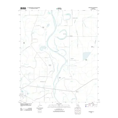
2012 Map of Wardview
USGS Topo · Published 2012About this map
Red River meanders define this landscape of oxbow lakes and alluvial plains near the Louisiana-Arkansas border. The area is characterized by remnants of the river's changing course, including the distinct Halfmoon Lake, Old River, and Old Bed Simpson Lake. Industry is woven into the terrain, primarily through the Wardview Oil Field and the Simpson Lake Oil and Gas Field, which occupy the fertile spaces between the water bodies.
Find a feature on this map
60 named features on this map. Tap any name to fly to it.
Don’t see what you’re looking for? This feature index may not catch every label — zoom into the map to look around manually.
Map Details
Editions of this 2012 Wardview Map
This is the sole edition of this map. No revisions or reprints were ever made.
Other maps of this area

1932 · Hosston NW
USGS Topo · 1:31,680

1932 · Hosston NE
USGS Topo · 1:31,680

1932 · Hosston SW
USGS Topo · 1:31,680

1932 · Hosston SE
USGS Topo · 1:31,680

1948 · Vivian
USGS Topo · 1:62,500

1950 · Plain Dealing SW
USGS Topo · 1:31,680

1950 · Plain Dealing NW
USGS Topo · 1:31,680

1952 · Doddridge SE
USGS Topo · 1:24,000

1952 · Bradley
USGS Topo · 1:24,000

1952 · Doddridge
USGS Topo · 1:24,000