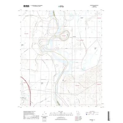
2018 Map of Wardview
USGS Topo · Published 2018About this map
The Red River snakes through the center of this landscape, its shifting course marked by numerous oxbow remnants and bypasses along the border of Caddo Parish and Bossier Parish. On the western edge, the town of Hosston is situated near Hosston Lake and the Hosston Cem, while the smaller settlement of Wardview lies to the east of the river. The complex fluvial history of the region is evident in features like Old Bed Horseshoe Lake, Halfmoon Lake, and the expansive Old Posten Lake Bed. These landforms indicate a terrain defined by ancient river migrations and modern drainage efforts, such as the Posten Bayou Canal. To the south, Millers Bluff rises above the bottomlands, providing a rare point of elevation in a territory otherwise dominated by bayous and sloughs like Kelly Bayou and Stumpy Bayou.
Find a feature on this map
64 named features on this map. Tap any name to fly to it.
Don’t see what you’re looking for? This feature index may not catch every label — zoom into the map to look around manually.
Map Details
Editions of this 2018 Wardview Map
This is the sole edition of this map. No revisions or reprints were ever made.
Other maps of this area

1932 · Hosston NW
USGS Topo · 1:31,680

1932 · Hosston NE
USGS Topo · 1:31,680

1932 · Hosston SW
USGS Topo · 1:31,680

1932 · Hosston SE
USGS Topo · 1:31,680

1948 · Vivian
USGS Topo · 1:62,500

1950 · Plain Dealing SW
USGS Topo · 1:31,680

1950 · Plain Dealing NW
USGS Topo · 1:31,680

1952 · Doddridge SE
USGS Topo · 1:24,000

1952 · Bradley
USGS Topo · 1:24,000

1952 · Doddridge
USGS Topo · 1:24,000