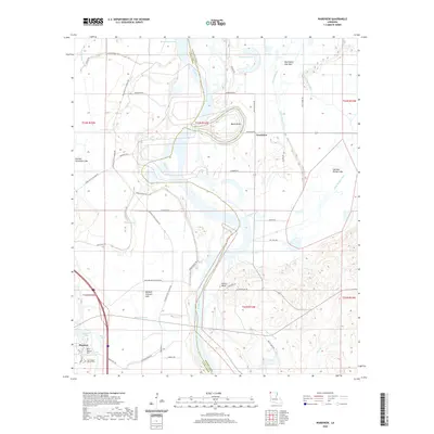
2020 Map of Wardview
USGS Topo · Published 2020About this map
The Red River defines the landscape of north Louisiana in this detailed 2020 study, winding through a complex of ancient oxbows and abandoned channels. The town of Hosston sits in the southwestern corner, serving as a focal point for local history with the Hosston Cem and the Star Chapel Church Cem nearby. The river's historical shifts are visible in features like Old Bed Horseshoe Lake, Old Bed Simpson Lake, and the dramatic Boom Bend, illustrating how the waterway has shaped the geography of Caddo Parish over generations.
Find a feature on this map
61 named features on this map. Tap any name to fly to it.
Don’t see what you’re looking for? This feature index may not catch every label — zoom into the map to look around manually.
Map Details
Editions of this 2020 Wardview Map
This is the sole edition of this map. No revisions or reprints were ever made.
Other maps of this area

1932 · Hosston NW
USGS Topo · 1:31,680

1932 · Hosston NE
USGS Topo · 1:31,680

1932 · Hosston SW
USGS Topo · 1:31,680

1932 · Hosston SE
USGS Topo · 1:31,680

1948 · Vivian
USGS Topo · 1:62,500

1950 · Plain Dealing SW
USGS Topo · 1:31,680

1950 · Plain Dealing NW
USGS Topo · 1:31,680

1952 · Doddridge SE
USGS Topo · 1:24,000

1952 · Bradley
USGS Topo · 1:24,000

1952 · Doddridge
USGS Topo · 1:24,000