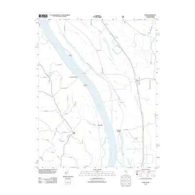
2012 Map of Ware
USGS Topo · Published 2012About this map
The Mississippi River defines the western edge of this landscape, carving a complex boundary between Missouri and Illinois through a series of landings and riverine features. Along the eastern banks, the settlement of Ware sits near the Union Co Conservation Area, while a network of agricultural drainages like Running Lake Ditch manage the low-lying bottomlands. These fertile plains are marked by historic river access points such as Willard Landing and Hamburg Landing, reflecting an era where the river served as the primary corridor for commerce and travel.
Find a feature on this map
66 named features on this map. Tap any name to fly to it.
Don’t see what you’re looking for? This feature index may not catch every label — zoom into the map to look around manually.
Map Details
Editions of this 2012 Ware Map
This is the sole edition of this map. No revisions or reprints were ever made.
Other maps of this area

1918 · Altenburg
USGS Topo · 1:62,500

1920 · Jonesboro
USGS Topo · 1:62,500

1922 · Cape Girardeau
USGS Topo · 1:62,500

1923 · Jonesboro
USGS Topo · 1:62,500

1924 · Cape Girardeau
USGS Topo · 1:62,500

1924 · Alto Pass
USGS Topo · 1:62,500

1925 · Altenburg
USGS Topo · 1:62,500

1947 · Jonesboro
USGS Topo · 1:62,500

1947 · Alto Pass
USGS Topo · 1:62,500

1947 · Mc Clure
USGS Topo · 1:24,000