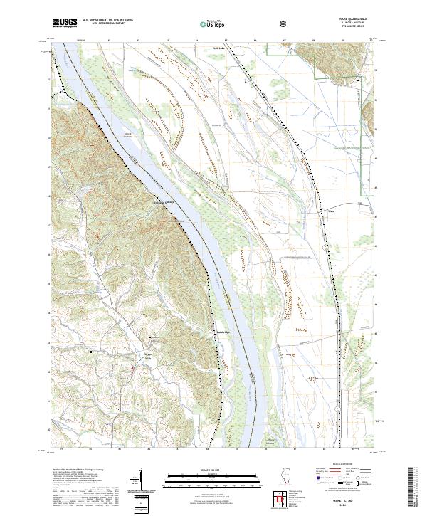
2024 Map of Ware
USGS Topo · Published 2024About this map
Egypt Mills and Bainbridge sit along the high bluffs overlooking the Mississippi River bottomlands, where the Illinois and Missouri border follows the shifting river channel. This modern survey illustrates a landscape of stark contrasts, from the upland ridges of the Shawnee National Forest to the engineered drainage of the floodplain. The river's influence is evident in features like Vancill Towhead and Sheppard Point, which define the navigation corridor between Union County and Cape Girardeau County. Genealogists will find significant value in the mapped locations of the Trinity Lutheran Church-Cem, Keyser Cem, and Ralls Cem. Significant infrastructure like the Miss River Levee Rd and drainage systems including Running Lake Ditch and Number 2 Ditch reveal the extensive efforts to manage the low-lying acreage surrounding Wolf Lake and Ware.
Find a feature on this map
68 named features on this map. Tap any name to fly to it.
Don’t see what you’re looking for? This feature index may not catch every label — zoom into the map to look around manually.
Map Details
Editions of this 2024 Ware Map
This is the sole edition of this map. No revisions or reprints were ever made.
Other maps of this area

1918 · Altenburg
USGS Topo · 1:62,500

1920 · Jonesboro
USGS Topo · 1:62,500

1922 · Cape Girardeau
USGS Topo · 1:62,500

1923 · Jonesboro
USGS Topo · 1:62,500

1924 · Cape Girardeau
USGS Topo · 1:62,500

1924 · Alto Pass
USGS Topo · 1:62,500

1925 · Altenburg
USGS Topo · 1:62,500

1947 · Jonesboro
USGS Topo · 1:62,500

1947 · Alto Pass
USGS Topo · 1:62,500

1947 · Mc Clure
USGS Topo · 1:24,000