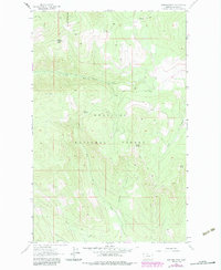
1963 Map of Warland Peak
USGS Topo · Published 1984About this map
Kootenai National Forest dominates this mountain landscape, centered on the high point of Warland Peak. A lookout tower sits atop the peak, overlooking a network of drainages including Cripple Horse Creek and Warland Creek. The map documents a landscape of steep timber and high ridgelines, where the primary infrastructure consists of a extensive system of a pack trail and various trails connecting remote water sources like Summit Spring. Toward the east, the terrain rises again toward Weigel Mountain and Wolf Point. This area reflects the mid-century management of the National Forest system, emphasizing fire observation and backcountry access through the rugged Lincoln County interior before more intensive modern development.
Find a feature on this map
18 named features on this map. Tap any name to fly to it.
Don’t see what you’re looking for? This feature index may not catch every label — zoom into the map to look around manually.
Map Details
Editions of this 1963 Warland Peak Map
2 editions found

Other maps of this area

1913 · Stryker
USGS Topo · 1:125,000

1916 · Stryker
USGS Topo · 1:125,000

1920 · Jennings
USGS Topo · 1:125,000

1935 · Thompson Lakes
USGS Topo · 1:96,000

1942 · Thompson Lakes
USGS Topo · 1:125,000

1957 · Kalispell
USGS Topo · 1:250,000

1960 · Kalispell
USGS Topo · 1:250,000

1961 · Kalispell
USGS Topo · 1:250,000

1963 · Wolf Prairie
USGS Topo · 1:24,000

1963 · Davis Mountain
USGS Topo · 1:24,000