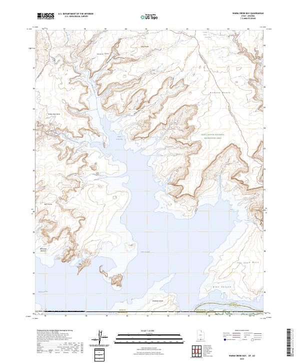
2023 Map of Warm Creek Bay
USGS Topo · Published 2023About this map
Glen Canyon National Recreation Area dominates this desert landscape, where the rising waters of Lake Powell meet the intricate network of the Colorado Plateau. The map reveals the dramatic geography of Warm Creek Bay and Wahweap Bay, showing the interplay between deep canyon inlets and elevated plateaus like Romana Bench and Pasture Point. These features indicate the region's character as a managed wilderness, where recreation and water management intersect. Notable landmarks such as Antelope Island and the Wahweap Window suggest a terrain of immense geological scale. The presence of specialized routes like the Alstrom Point Trl and Gunsight Canyon Trl highlights how the area is navigated, following the natural contours of landmarks like Prickly Pear Point and Wagon Box Canyon. This documentation serves researchers tracking shoreline changes and the distribution of named landmarks across the Utah and Arizona borderlands.
Find a feature on this map
35 named features on this map. Tap any name to fly to it.
Don’t see what you’re looking for? This feature index may not catch every label — zoom into the map to look around manually.
Map Details
Editions of this 2023 Warm Creek Bay Map
This is the sole edition of this map. No revisions or reprints were ever made.
Other maps of this area

1886 · Escalante
USGS Topo · 1:250,000

1886 · Echo Cliffs
USGS Topo · 1:250,000

1891 · Echo Cliffs
USGS Topo · 1:250,000

1922 · Warm Creek
USGS Topo · 1:63,360

1951 · Lees Ferry NE
USGS Topo · 1:24,000

1953 · Nipple Butte
USGS Topo · 1:62,500

1953 · Gunsight Butte
USGS Topo · 1:62,500

1954 · Leche-E Rock
USGS Topo · 1:62,500

1954 · Lees Ferry
USGS Topo · 1:62,500

1956 · Escalante
USGS Topo · 1:250,000