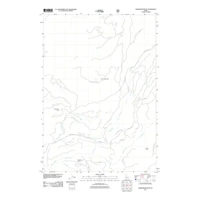
2011 Map of Warm River Butte
USGS Topo · Published 2011About this map
Moose Creek Butte and Warm River Butte anchor this high-country landscape in Fremont County, dominated by the drainage systems of the Targhee National Forest region. The 2011 survey reveals an intricate network of forest service and mountain roads, including the Snow Creek Rd and Warm River Butte Rd, which provide access to remote peaks and springs. The terrain is defined by its water sources, from the Fish Creek Spring to the various branches of Fish Creek and Robinson Creek. To the south, Huckleberry Ridge separates the creek beds, while Rising Butte stands prominently in the southeast. This map captures the modern recreational and resource management infrastructure of the Idaho backcountry, where names like Bear Creek and Moose Creek reflect the local wildlife and geography.
Find a feature on this map
27 named features on this map. Tap any name to fly to it.
Don’t see what you’re looking for? This feature index may not catch every label — zoom into the map to look around manually.
Map Details
Editions of this 2011 Warm River Butte Map
This is the sole edition of this map. No revisions or reprints were ever made.
Other maps of this area

1955 · Ashton
USGS Topo · 1:250,000

1957 · Warm River Butte
USGS Topo · 1:62,500

1957 · Buffalo Lake
USGS Topo · 1:62,500

1958 · Ashton
USGS Topo · 1:250,000

1960 · Ashton
USGS Topo · 1:250,000

1964 · Hatchery Butte
USGS Topo · 1:24,000

1965 · Snake River Butte
USGS Topo · 1:24,000
1965 · Warm River
USGS Topo · 1:24,000
1986 · Buffalo Lake
USGS Topo · 1:24,000
1986 · Big Grassy
USGS Topo · 1:24,000