
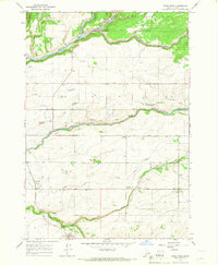
1965 Map of Snake River Butte
USGS Topo · Published 1967About this map
Targhee National Forest dominates this mid-1960s survey, defined by the dramatic descent of Henrys Fork through the volcanic terrain of eastern Idaho. The river’s course is punctuated by significant landmarks including Upper Mesa Falls, Lower Mesa Falls, and the Grandview Overlook. To the east, the Warm River valley supports local infrastructure such as the Warm River Fish Hatchery and the Bear Gulch Ski Area.
Find a feature on this map
34 named features on this map. Tap any name to fly to it.
Don’t see what you’re looking for? This feature index may not catch every label — zoom into the map to look around manually.
Map Details
Editions of this 1965 Snake River Butte Map
This is the sole edition of this map. No revisions or reprints were ever made.
Other maps of this area

1955 · Ashton
USGS Topo · 1:250,000

1957 · Warm River Butte
USGS Topo · 1:62,500

1957 · Buffalo Lake
USGS Topo · 1:62,500

1958 · Ashton
USGS Topo · 1:250,000

1960 · Ashton
USGS Topo · 1:250,000

1964 · Hatchery Butte
USGS Topo · 1:24,000

1964 · Last Chance
USGS Topo · 1:24,000

1965 · Ashton
USGS Topo · 1:24,000

1965 · Lookout Butte
USGS Topo · 1:24,000
1965 · Warm River
USGS Topo · 1:24,000