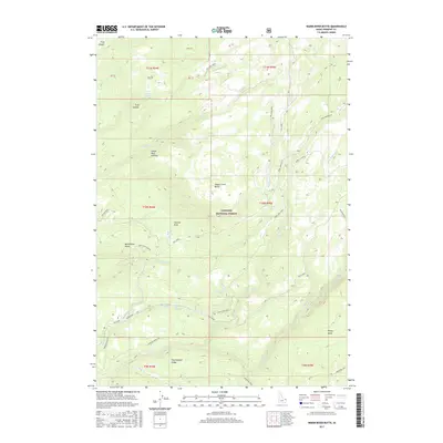
2017 Map of Warm River Butte
USGS Topo · Published 2017About this map
The Island Park Caldera dominates the western portion of this 2017 survey of Fremont County, marking a landscape defined by significant volcanic history and the high elevations of the Targhee National Forest. The map detail captures a complex drainage system where Moose Creek and N Fork Fish Creek carve through the terrain, fed by remote water sources like Trail Canyon Spring and Otter Springs. High points such as Warm River Butte and Moose Creek Butte rise above the surrounding forest, with the Warm River Lookout positioned as a vital vantage point for fire management.
Find a feature on this map
40 named features on this map. Tap any name to fly to it.
Don’t see what you’re looking for? This feature index may not catch every label — zoom into the map to look around manually.
Map Details
Editions of this 2017 Warm River Butte Map
This is the sole edition of this map. No revisions or reprints were ever made.
Other maps of this area

1955 · Ashton
USGS Topo · 1:250,000

1957 · Warm River Butte
USGS Topo · 1:62,500

1957 · Buffalo Lake
USGS Topo · 1:62,500

1958 · Ashton
USGS Topo · 1:250,000

1960 · Ashton
USGS Topo · 1:250,000

1964 · Hatchery Butte
USGS Topo · 1:24,000

1965 · Snake River Butte
USGS Topo · 1:24,000
1965 · Warm River
USGS Topo · 1:24,000
1986 · Buffalo Lake
USGS Topo · 1:24,000
1986 · Big Grassy
USGS Topo · 1:24,000