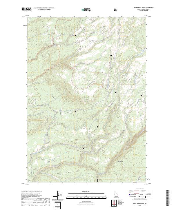
2023 Map of Warm River Butte
USGS Topo · Published 2023About this map
Island Park Caldera marks the high-elevation volcanic landscape within this section of the Targhee National Forest. The topography is defined by a series of prominent rises including Moose Creek Butte, Rising Butte, and Warm River Butte, where the Warm River Lookout provides a strategic vantage point over the forest. This area is heavily dissected by drainage networks, primarily Fish Creek, Robinson Creek, and Moose Creek, which cut through the complex terrain. The map details an extensive system of forest roads and trails, such as the Moose Creek Butte Rd and Camp Ridge Tri, reflecting a landscape managed for both timber and recreation. Water sources like Otter Springs and Bear Spring are scattered throughout, providing essential points of interest for those navigating the high country of Huckleberry Ridge.
Find a feature on this map
39 named features on this map. Tap any name to fly to it.
Don’t see what you’re looking for? This feature index may not catch every label — zoom into the map to look around manually.
Map Details
Editions of this 2023 Warm River Butte Map
This is the sole edition of this map. No revisions or reprints were ever made.
Other maps of this area

1955 · Ashton
USGS Topo · 1:250,000

1957 · Warm River Butte
USGS Topo · 1:62,500

1957 · Buffalo Lake
USGS Topo · 1:62,500

1958 · Ashton
USGS Topo · 1:250,000

1960 · Ashton
USGS Topo · 1:250,000

1964 · Hatchery Butte
USGS Topo · 1:24,000

1965 · Snake River Butte
USGS Topo · 1:24,000
1965 · Warm River
USGS Topo · 1:24,000
1986 · Buffalo Lake
USGS Topo · 1:24,000
1986 · Big Grassy
USGS Topo · 1:24,000