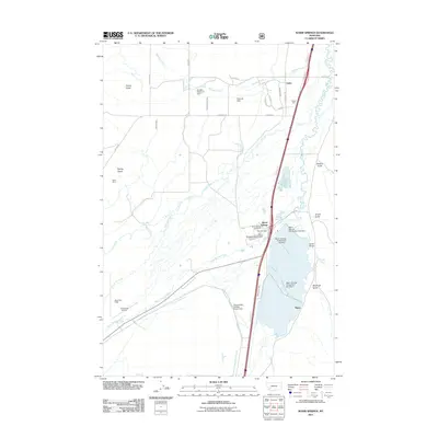
2011 Map of Warm Springs
USGS Topo · Published 2011About this map
Industrial and water management infrastructure dominates this Montana valley north of Anaconda. The settlement at Warm Springs is anchored by the Warmsprings Post Office and the Warm Springs Creek Bridge, situated near a series of massive sediment structures including Warm Springs Tailing Dam Number 1, Number 2, and Number 3. To the south, the Opportunity Tailings Ponds Dam further illustrates the legacy of regional mining operations.
Find a feature on this map
41 named features on this map. Tap any name to fly to it.
Don’t see what you’re looking for? This feature index may not catch every label — zoom into the map to look around manually.
Map Details
Editions of this 2011 Warm Springs Map
This is the sole edition of this map. No revisions or reprints were ever made.
Other maps of this area

1889 · Helena
USGS Topo · 1:250,000

1893 · Helena
USGS Topo · 1:250,000

1899 · Helena
USGS Topo · 1:250,000

1903 · Helena
USGS Topo · 1:250,000

1947 · Butte
USGS Topo · 1:250,000
1958 · Butte
USGS Topo · 1:250,000
1959 · Butte North
USGS Topo · 1:62,500
1959 · Deer Lodge
USGS Topo · 1:62,500
1960 · Butte
USGS Topo · 1:250,000
1961 · Anaconda
USGS Topo · 1:62,500