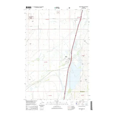
2017 Map of Warm Springs
USGS Topo · Published 2017About this map
Warm Springs and the surrounding river valley are captured here at the boundary of Deer Lodge and Silver Bow Counties. The landscape is defined by a complex network of irrigation and water management, including the Fifer-Cummock Ditch, Gardiner Ditch, and Jacobson Ditch, which divert water toward the agricultural lands flanking the Clark Fork. Transportation history is layered across the terrain, from the modern highway system to the historic Yellowstone Trl, connecting small settlements like Galen and Morel. On the western edge, the foothills of the Deerlodge National Forest rise above Prairie Gulch, while the valley floor is punctuated by features like Bowman Field and structural crossings including the Warm Springs Creek Bridge.
Find a feature on this map
48 named features on this map. Tap any name to fly to it.
Don’t see what you’re looking for? This feature index may not catch every label — zoom into the map to look around manually.
Map Details
Editions of this 2017 Warm Springs Map
This is the sole edition of this map. No revisions or reprints were ever made.
Other maps of this area

1889 · Helena
USGS Topo · 1:250,000

1893 · Helena
USGS Topo · 1:250,000

1899 · Helena
USGS Topo · 1:250,000

1903 · Helena
USGS Topo · 1:250,000

1947 · Butte
USGS Topo · 1:250,000

1958 · Butte
USGS Topo · 1:250,000

1959 · Butte North
USGS Topo · 1:62,500

1959 · Deer Lodge
USGS Topo · 1:62,500

1960 · Butte
USGS Topo · 1:250,000

1961 · Anaconda
USGS Topo · 1:62,500