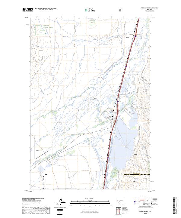
2024 Map of Warm Springs
USGS Topo · Published 2024About this map
Warm Springs anchors this section of the Clark Fork Valley, where the landscape is defined by an intricate network of irrigation and water management features. Agricultural and ranching infrastructure is prominent, evidenced by the Jacobson Ditch, Gardiner Ditch, and Fifer-Cummock Ditch which lace across the terrain. These systems divert water from several drainages, including Lost Creek and Modesty Creek, to support the valley floor. To the west, the boundary of the Deerlodge National Forest marks the transition into more elevated, timbered country. The transportation corridor follows the valley north-south, represented by the Mill-Willow Bypass railroad and the presence of the small settlements of Galen and Morel. The map also captures the rugged eastern edge of the Boulder Mountains, where deep drainages like Whitecraft Gulch and Girard Gulch descend toward the river.
Find a feature on this map
50 named features on this map. Tap any name to fly to it.
Don’t see what you’re looking for? This feature index may not catch every label — zoom into the map to look around manually.
Map Details
Editions of this 2024 Warm Springs Map
This is the sole edition of this map. No revisions or reprints were ever made.
Other maps of this area

1889 · Helena
USGS Topo · 1:250,000

1893 · Helena
USGS Topo · 1:250,000

1899 · Helena
USGS Topo · 1:250,000

1903 · Helena
USGS Topo · 1:250,000

1947 · Butte
USGS Topo · 1:250,000

1958 · Butte
USGS Topo · 1:250,000

1959 · Butte North
USGS Topo · 1:62,500

1959 · Deer Lodge
USGS Topo · 1:62,500

1960 · Butte
USGS Topo · 1:250,000

1961 · Anaconda
USGS Topo · 1:62,500