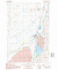
1989 Map of Warm Springs
USGS Topo · Published 1989About this map
Montana State Hospital Warm Springs Campus and the nearby Galen Campus anchor this landscape along the valley of the Clark Fork. The area is defined by a heavy industrial and institutional footprint, where massive tailings ponds and extensive networks of a levee and road on levee manage the environmental impact of the region's mining legacy. The transition from industrial infrastructure to the foothills is marked by numerous drainages including Modesty Creek, Lost Creek, and Dutchman Gulch, which feed into the primary river system.
Find a feature on this map
29 named features on this map. Tap any name to fly to it.
Don’t see what you’re looking for? This feature index may not catch every label — zoom into the map to look around manually.
Map Details
Editions of this 1989 Warm Springs Map
This is the sole edition of this map. No revisions or reprints were ever made.
Other maps of this area

1889 · Helena
USGS Topo · 1:250,000

1893 · Helena
USGS Topo · 1:250,000

1899 · Helena
USGS Topo · 1:250,000

1903 · Helena
USGS Topo · 1:250,000

1947 · Butte
USGS Topo · 1:250,000

1958 · Butte
USGS Topo · 1:250,000

1959 · Butte North
USGS Topo · 1:62,500

1959 · Deer Lodge
USGS Topo · 1:62,500

1960 · Butte
USGS Topo · 1:250,000

1961 · Anaconda
USGS Topo · 1:62,500