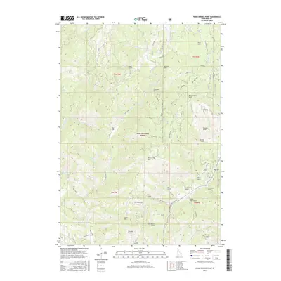
2017 Map of Warm Springs Point
USGS Topo · Published 2017About this map
Warm Springs Point dominates the central landscape of this section of the Boise National Forest, situated north of the Casher Mtn peak. This 2017 survey details a complex network of drainages including Grimes Creek, Macks Creek, and the southern Mores Cr, which is followed by the Ponderosa Pine Scenic Route. The naming of the landscape reflects a heritage of early prospecting and ranching, evidenced by features such as Monazite Gulch, Milk-Ranch Gulch, and Tollgate Gulch. While the area is largely mountainous, the presence of Rye Flat and a dense web of forest roads like Yankee Road and Bowrey Road indicate ongoing land use and recreation within the Boise Basin. Local history and geology are further illuminated by family-named or descriptive landmarks like Stierman Gulch, Johnny Woods Gulch, and Deadhorse Gulch.
Find a feature on this map
88 named features on this map. Tap any name to fly to it.
Don’t see what you’re looking for? This feature index may not catch every label — zoom into the map to look around manually.
Map Details
Editions of this 2017 Warm Springs Point Map
This is the sole edition of this map. No revisions or reprints were ever made.
Other maps of this area

1892 · Boise
USGS Topo · 1:125,000

1894 · Idaho Basin
USGS Topo · 1:125,000

1897 · Boise
USGS Topo · 1:125,000

1949 · Robie Creek
USGS Topo · 1:24,000

1954 · Boise
USGS Topo · 1:62,500

1955 · Hailey
USGS Topo · 1:250,000

1955 · Boise
USGS Topo · 1:250,000

1957 · Placerville
USGS Topo · 1:24,000

1957 · Pioneerville
USGS Topo · 1:24,000

1957 · Warm Springs Point
USGS Topo · 1:24,000