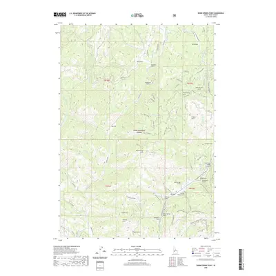
2020 Map of Warm Springs Point
USGS Topo · Published 2020About this map
Boise Basin geography dominates this portion of the Boise National Forest, where steep drainages and ridge-running forest roads define the landscape. The map showcases a network of named gulches and creeks, including Monazite Gulch, Hahn Gulch, and Deadhorse Gulch, which historically signify the region's mineral interests and ranching heritage. Significant topographic features like Casner Mtn and Warm Springs Point provide high-elevation landmarks overlooking the complex river systems of Grimes Creek and Mores Cr. A modern infrastructure of forest service routes, such as the Ponderosa Pine Scenic Route and the Ida City-Horseshoe Bend road, navigates the deep valleys. The layout of names like Milk Ranch Gulch and Stierman Gulch offers a glimpse into early settlement and land use patterns within this rugged Idaho interior.
Find a feature on this map
64 named features on this map. Tap any name to fly to it.
Don’t see what you’re looking for? This feature index may not catch every label — zoom into the map to look around manually.
Map Details
Editions of this 2020 Warm Springs Point Map
This is the sole edition of this map. No revisions or reprints were ever made.
Other maps of this area

1892 · Boise
USGS Topo · 1:125,000

1894 · Idaho Basin
USGS Topo · 1:125,000

1897 · Boise
USGS Topo · 1:125,000

1949 · Robie Creek
USGS Topo · 1:24,000

1954 · Boise
USGS Topo · 1:62,500

1955 · Hailey
USGS Topo · 1:250,000

1955 · Boise
USGS Topo · 1:250,000

1957 · Placerville
USGS Topo · 1:24,000

1957 · Pioneerville
USGS Topo · 1:24,000

1957 · Warm Springs Point
USGS Topo · 1:24,000